The Artful Map
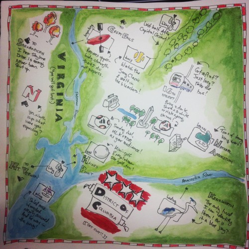
 After a week in San Francisco, I returned to North Cascades Institute just in time for Jocelyn Curry’s Artful Map class. I had no idea what to expect, but I thought it might be interesting to produce a map focused on my home of Washington, DC, with an emphasis on all the outdoor activities possible in the city, including biking and soccer, two of my favorites. When most people think of DC, they think of museums and cranky old white guys arguing with each other all day, but the city’s cycling and jogging paths are packed on weekends, and the international nature of its residents means you never have to go far to find a soccer game.
Jocelyn started off by showing us all some popular books and some of her own work, for inspiration. Then she shared some watercolor basics for those of us who hadn’t touched a brush since we were seven years old. Next, some simple calligraphy instruction using one of those old-fashioned nib pens and a bottle of India ink. Jocelyn also provided us with some templates we could use to copy banners, compasses, sea-monsters, and other artful icons that cartographers have loved for centuries.
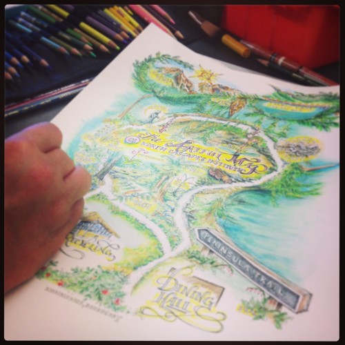 A map of the Learning Center created by one of the participants

I opted for more of a hand-drawn, casual feel with simple icons denoting sports like kayaking and golf, along with some wise-cracking comments that reveal my personality. We all sketched our early ideas on scrap paper, then used a light table to trace our favorite pieces on to the final product. Other students crafted maps that showed where they’d lived over the years, where they’d honeymooned, where they’d hiked, and, of course, the Environmental Learning Center where we’d all spend the weekend.
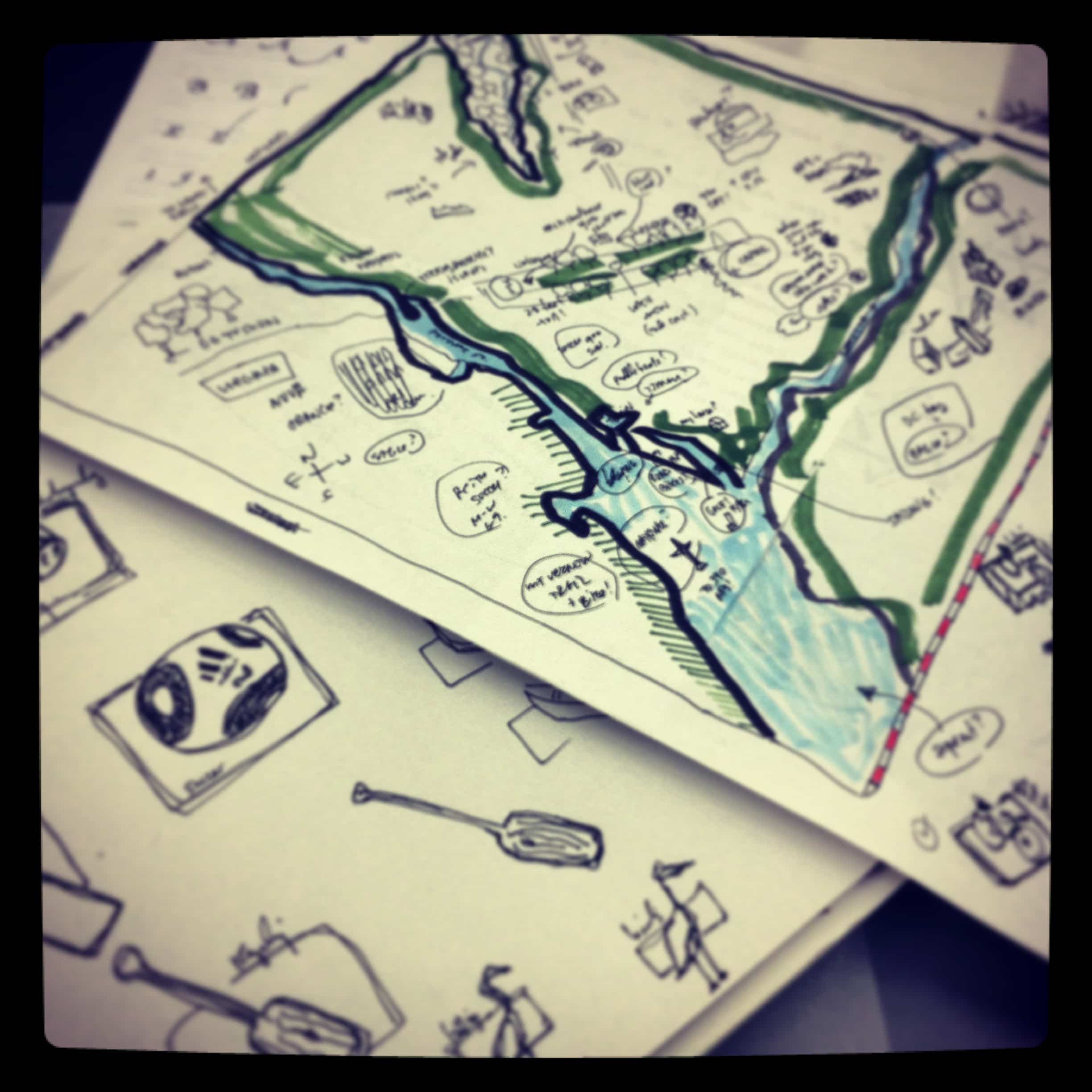
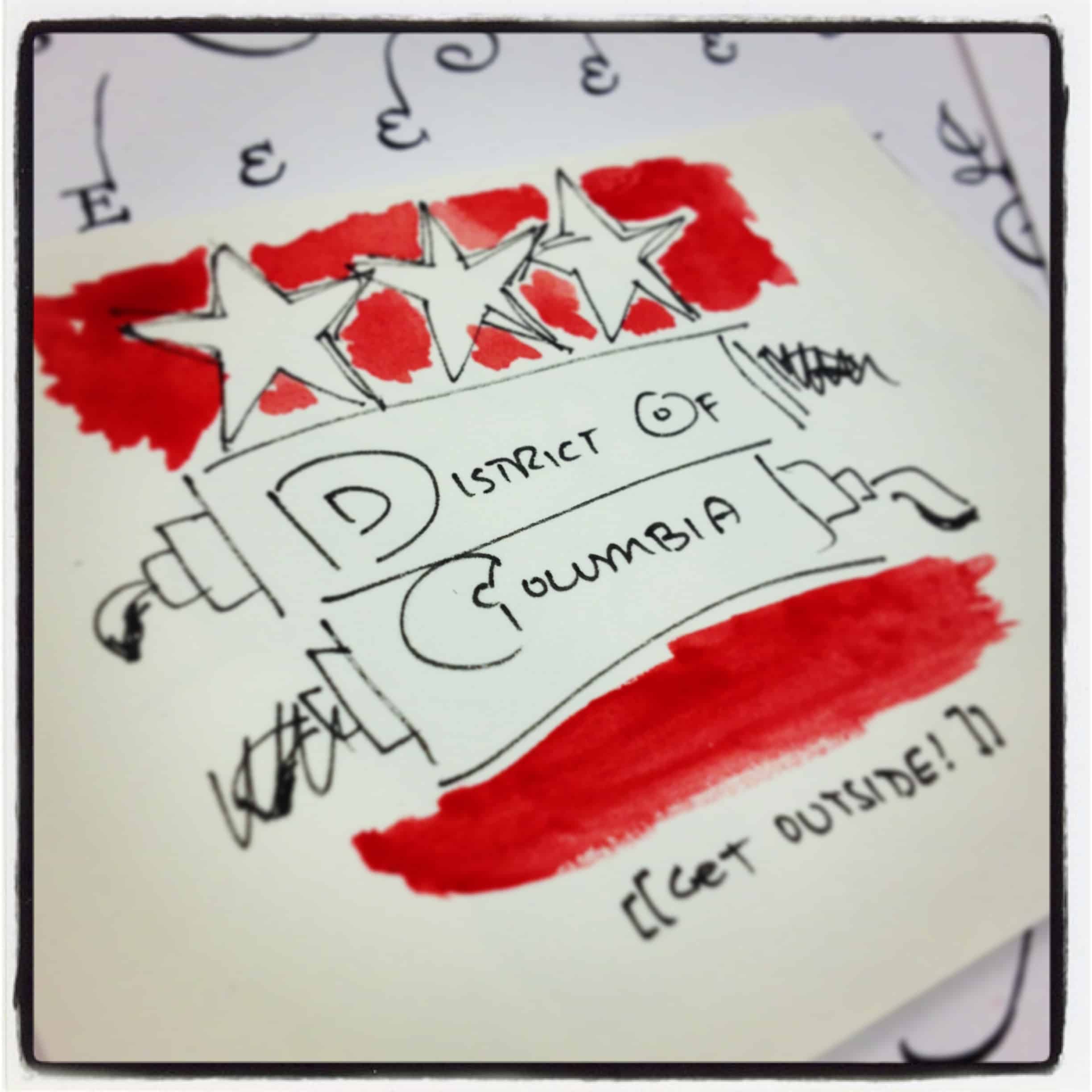
 (above three photos) Various stages of Scott’s progress on his own maps

The water-color work was scary, especially since we were only given one piece of paper, but I embraced the mistakes and ultimately they gave the piece character. Most of us were all a little envious of the work of our fellow students, but I think everyone was really happy with their own work, because regardless of the quality of the calligraphy or the accuracy of the flora and fauna portrayed, it told our story—stories we shared with one another at the end of the day. Stories we can share with our friends and family when we return home and post our work on the refrigerator for everyone to see.
Leading photo: A map of Mount Baker created by North Cascades Institute Graduate Program Coordinator Stephanie Bennett.
Scott Kirkwood is editor in chief of National Parks Magazine, a quarterly publication produced by the National Parks Conservation Association, a nonprofit advocacy organization headquartered in Washington, D.C. This is his third post in a series about spending the summer in the North Cascades National Park.