Planning for roads in the Mt. Baker-Snoqualmie National Forest
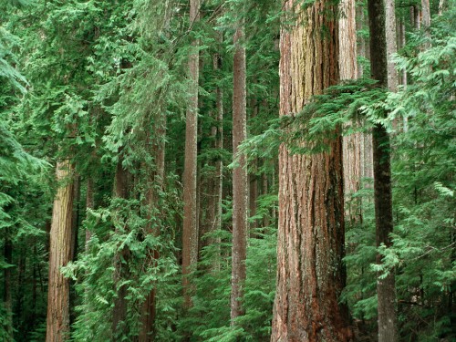
Each year five million people visit the Mt. Baker-Snoqualmie National Forest in Washington State. They drive forest roads to experience spectacular vistas at places such as Mt. Baker, Heather Meadows, Skagit Wild and Scenic River and Pacific Crest National Scenic Trail and to access countless other public lands for recreation, field science and naturalizing, family activities, spiritual renewal and exploration.
Approximately 2,500 miles of roads crisscross the forest, from the Canadian border to the Mt. Rainier National Park on the western Cascades. The Forest Service can afford to maintain about a quarter of them. Guided by mandates in the 2005 Travel Management Rule, each national forest must identify a road system by 2015 within budget for safe travel, use, administration and resource protection. To complete this report, the Mt. Baker-Snoqualmie National Forest staff wants to find out what roads are important to the public and why.
Eight meetings are scheduled June through October in Seattle, Sedro-Woolley, Issaquah, Bellingham, Enumclaw, Monroe and Everett. Those who do not attend a meeting will be able to give their input online. Partners and stakeholders representing a broad range of interests, from environmental, timber industry to off-road vehicle groups, have formed a “Sustainable Roads Cadre” to engage the public in the process.
MEETING SCHEDULE:
June 29, 10 a.m.-12:30 noon Seattle, REI downtown
July 9, 10 a.m.-12:30 noon Sedro-Woolley, Mt. Baker District office
July 23, 5:30-8 p.m. Issaquah Main Fire Station office
Aug. 6, 11 a.m.-1:30 p.m. Enumclaw Public Library
Aug. 21, 4:30-7 p.m. Darrington Public Library
Sept. 10, 5:30-8 p.m. Bellingham Public Library
Sept. 24, 1-3:30 p.m. Monroe Public Library
Oct. 9, 5:30-8 p.m. Everett Public Library downtown
A science-driven approach developed by the Forest Service’s Pacific Northwest Research Station and Portland State University will be used to understand how people use and value landscapes and resources. Social scientists from the lab will guide meeting participants in using maps to identify places of significance and assign values or activities associated with them.
For more information, contact Renee Bodine at rbodine@fs.fed.us.
Photo by Brett Baunton.