The Mountain Behind the Name: Sauk
The North Cascades Ecosystem has many features to discover for naturalists, students and day hikers alike. Behind all the charismatic megafauna and flora including bears, wolverines, Douglas Firs and Western Hemlocks are the mountains that make it all possible. In this series, we take a look at the “charismatic mega-rocks” that make the North Cascades one of the greatest natural wonders of this nation. First up, Sauk Mountain.

Geologic Map of part of the North Cascades courtesy of USGS
Geology
The above map is as informative to local geologists as scores are to musical composers. Each color represents a different rock type. The many rock types can be grouped into three different regions. The northeast part is the Methow Domain, containing “sandstone and conglomerates deposited by streams and shallow, fresh, and saltwater” colored in reds and greens. The southern and middle parts, named Metamorphic Core Domain, contain metamorphic rock that has been pushed toward the surface (colored in earthy browns and yellows).
And to the west, in the Western Domain colored in blues, contains a mixture of volcanic and sedimentary rocks. Mt. Baker, the second most thermally active volcano in the North Cascades, contributed so much to the geology of Sauk. Located 19 miles south east of Baker, Sauk is covered in mostly sedimentary and igneous rock.
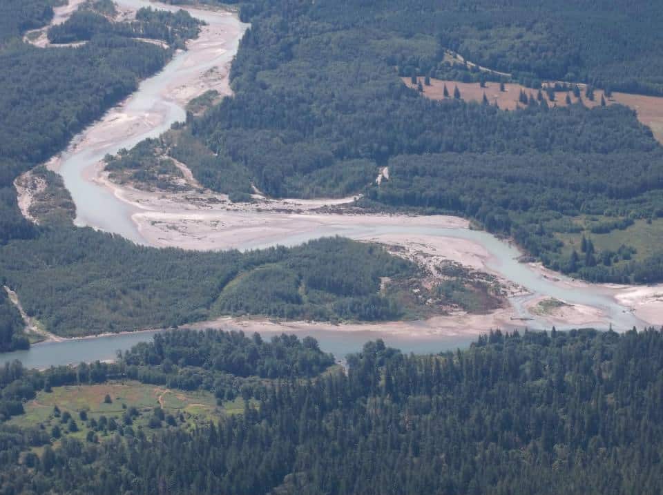
Confluence of the Sauk (Upper) and Skagit (Lower) Rivers.
History
The name Sauk comes from the now Sauk-Suiattle tribe which still live in the area. In their own words on their website, “we lived as hunters, gathers and fishermen in the region of the Sauk Prairie near the present-day town of Darrington, Washington. In the early days, we were known as the Sah-ku-mehu.”
For generations they canoed, hunted, and lived on the Sauk and Skagit rivers, both in the shadow of Sauk Mountain. At times they traded with tribes in the Eastern part of the state, as well as traveled to the Salish Sea.
Directions and Trails
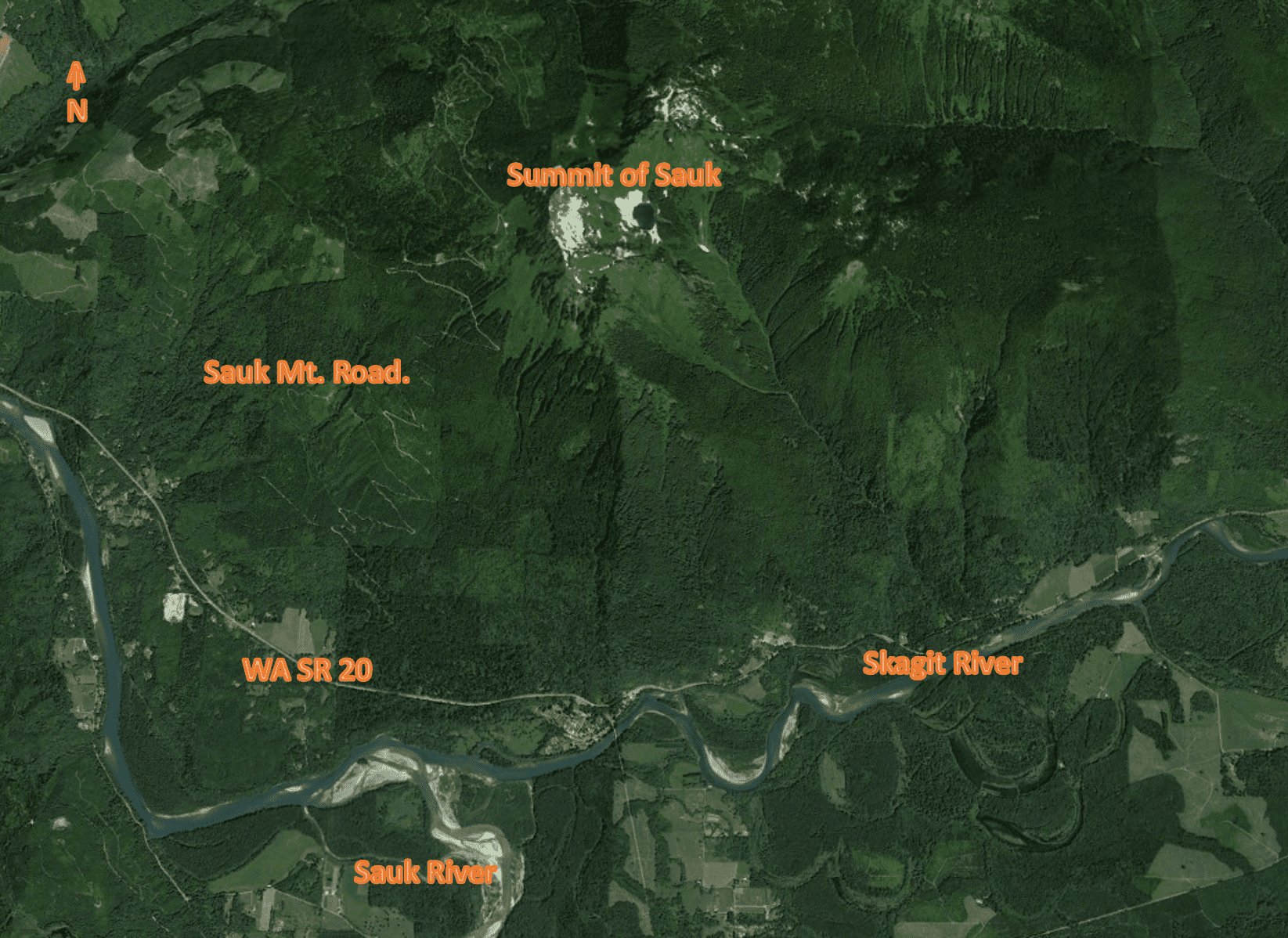
Starting from I-5 near Burlington, travel east on Washington Route 20 for 45 miles. You will pass through Sedro-Woolley, Lyman, and Concrete. If you go past the 530 intersection, you have gone too far.
The road will be on your left, appropriately named Sauk Mountain Road. Follow the steep, narrow road for about eight miles until it ends at the trail head. There is enough room to park a dozen cars.
The trail starts with a cute little A-framed outhouse before your hike. While being just above four miles round trip, you will be going on switch back after switch back. While going up you will have plenty of time to take in all of the Skagit River watershed. You will gain 1,200 feet in elevation from the start of the trail head to summit. As John Reidel told the 15th Cohort Class at the North Cascades Institute on our first time on Sauk, the “hike is sinfully short for how amazing the views are.”
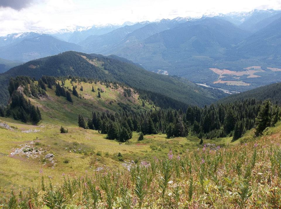
Wildflowers in the Summer at Sauk
Habitat
The habitat of the whole North Cascades region is effected by two major factors: the mountains and the sea. Water is picked up in the Salish sea heading inland. The North Cascades mountain range block most of that, creating an orographic effect. The rain shadow created makes the Methow Valley on the eastern slopes very dry, while Sauk and the rest in the Western Slopes get covered in precipitation.
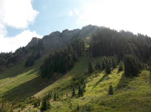
The mountain goes through three ecoregions, or distinct types of habitats, all based around elevation. Even though some of the mountain is covered in open fields with wildflowers, the regions are labeled by the dominant tree.
At the base to 2,500 ft is the Western Hemlock ecoregion. Containing western hemlocks, Douglas firs, salal, and Oregon grape, the forests feel much like those along WA State Route 20.
As you travel up Sauk Mountain Road, it transitions to a Silver Fir ecoregion from 2,500 ft to 4,300 ft. Hardier silver fir trees are needed to withstand the colder temperatures, although you will also find plenty of Douglas firs there as well.
When you reach the parking lot to start on the trail, you will officially be in third and final region: Subalpine Mountain Hemlock. On Sauk the dense forests open up to open meadows with scattered forests. Plenty of wildflowers dot the land in the spring and summer. This region continues all the way to the summit at 5,544 ft. You will see plenty of wildflowers, so make sure to schedule enough time to stop and identify them! This is also the habitat that pikas and hoary marmots may be seen.
Mt. Shuckson, 21 miles North of Sauk
View
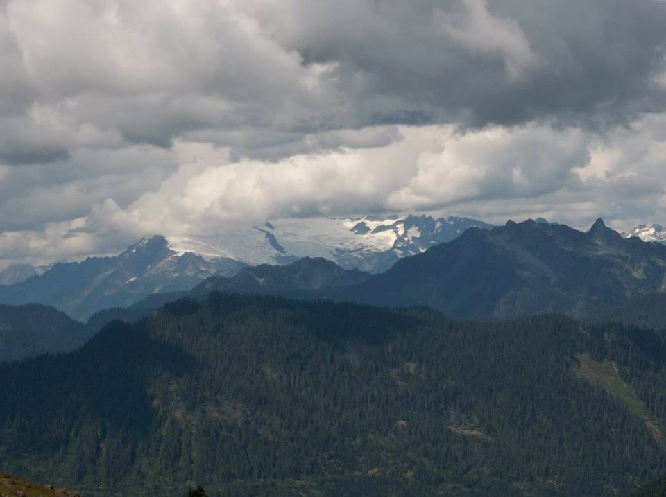
At 5541 feet the views are breathtaking. Shuckson and Baker to the north and White Horse to the south are always eye-catchers. But on a clear, sunny day you can see all the way out to the Salish Sea!
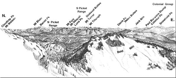
Some of the mountains that can be seen from the summit. Photo courtesy of USGS.
Pictures are wonderful but pale in comparison to seeing it yourself. After the snow has started to melt and the wildflowers started to bloom, go see just how wonderful this charismatic mega rock is for your own eyes.
Great information here. I will pass it along to someone new in the area who would like to visit Sauk in the spring. Keep up the good writing.