New hand-illustrated North Cascades National Park map
Xplorer Maps Releases Hand-Illustrated North Cascades National Park Map, Donates Percentage of Map Sales to Ongoing Park Support
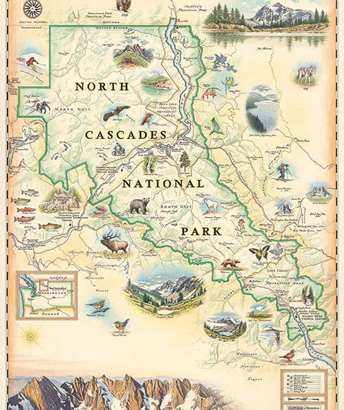
MISSOULA, MT – Xplorer Maps, the creators of hand-illustrated maps of national parks and travel destinations throughout the world, announced today that it has released the newest fine-art map, North Cascades National Park, highlighting jagged peaks topped by more than 300 glaciers, cascading waters in forested valleys and abundant wildlife.
World-renowned artist Chris Robitaille, co-founder of Xplorer Maps, illustrated the map using an antique, old-world style and featuring the iconic images from the national park located in Washington. The map features geographic marvels like Mount Shuksan and the Picket Range while paying homage to hikers, skiers and bikers who enjoy the park’s many recreational opportunities.
The map was produced in partnership with North Cascades National Park Service Complex and the North Cascades Institute, a conservation nonprofit based in western Washington that works to inspire and empower environmental stewardship through transformative experiences in nature. Xplorer Maps will donate a percentage of proceeds in perpetuity from map sales to the Institute to support youth education opportunities to help create the next generation of public lands stewards.
“North Cascades National Park Service Complex and the North Cascades Institute are ideal partners for Xplorer Maps,” according to Greg Robitaille, CEO and co-founder of Xplorer Maps. “Both organizations demonstrated obvious passion, knowledge and expertise in this collaborative project. The attention to detail helped facilitate a truly unique and exceptional end product.”
“We were looking for something unique to the park, not something that was a cookie cutter approach,” according to Patrick Renau, the retail manager at the North Cascades Institute. “Our goal was for someone to see the map and say, ‘it represents my visit and experience so well that I have to have it.’”
“One of the challenges of creating the map was taking the dramatic landscapes and accurately transcribing them in a sketch,” Renau said. “Consistent communications with Xplorer Maps was one of the reasons for the project’s success. We all worked together to determine what cultural, biological and geographic aspects would be highlighted.”
Renau said he is pleased that the map was produced and delivered on time and was in stores for Memorial Day weekend. This fine-art illustrated map of North Cascades National Park is available at www.north-cascades-institute.shoplightspeed.com and in select visitor centers and retail shops in Washington.